ICS has a full collection of maps that reflect the history of the Eastern Mediterranean region, especially over the past century. All of the maps are free and can be downloaded for classroom use.
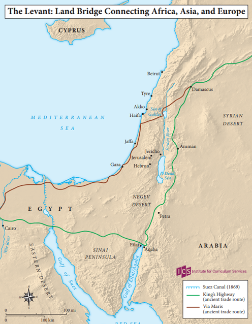
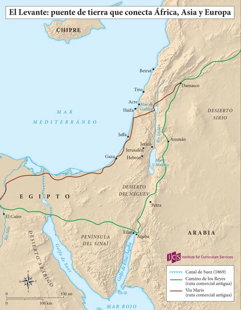
01 – Levant Land Bridge
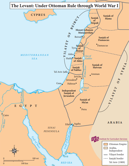
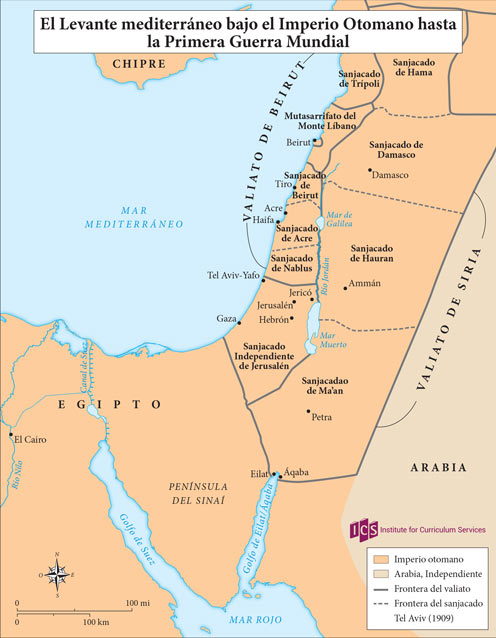
02 – Levant under the Ottomans
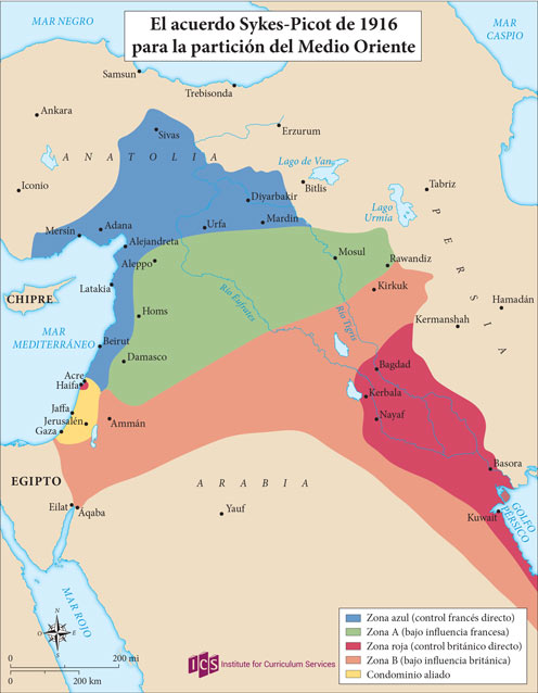
03 – Sykes-Picot Agreement

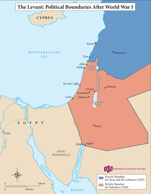
04 – Levant after WW1
05 – Separation of Transjordan

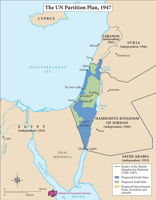
06 – UN Partition Plan
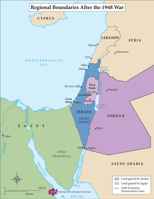
07 – Regional Boundaries after 1948 War
08 – Israel after 1967 War

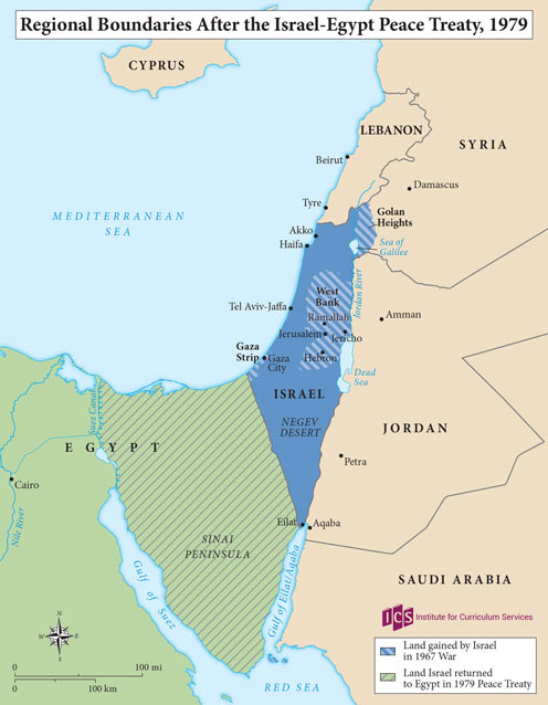
09 – Regional Boundaries 1979
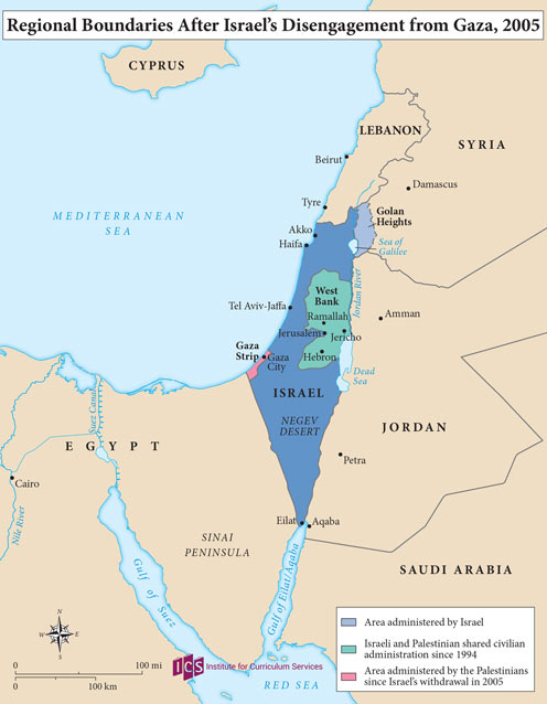
10 – Regional Boundaries 2005
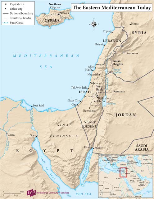
11 – Eastern Mediterranean Today
Spanish 01 – El Levante puente de tierra que conecta Africa Asia Europa
Spanish 02 – El Levante mediterraneo bajo el Otomano
Spanish 03 – El acuerdo Sykes-Picot
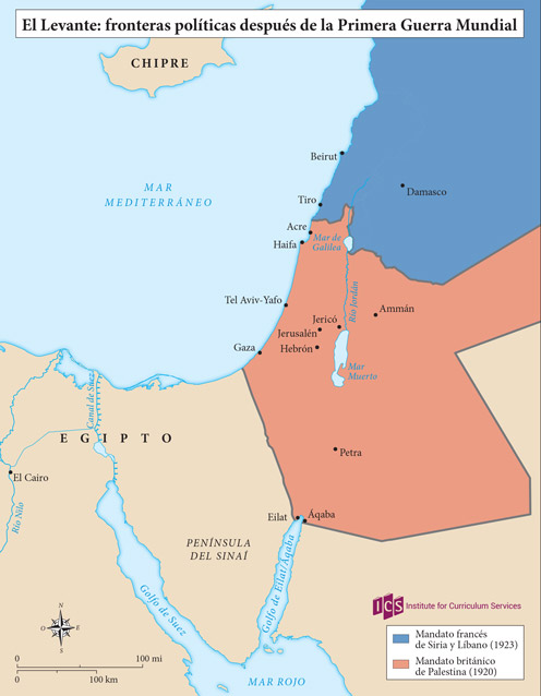
Spanish 04 – El Levante después de la Primera Guerra Mundial
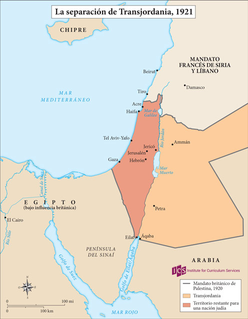
Spanish 05 – La Separación de Transjordani
Spanish 06 – Plan de Partición 1947

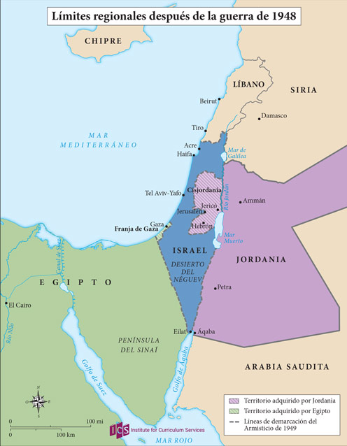
Spanish 07 – Límites regionales 1948
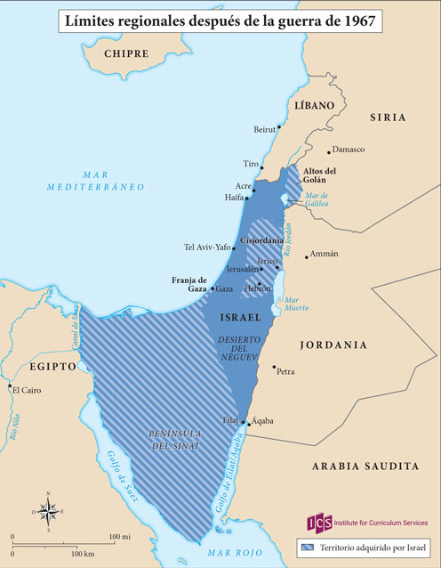
Spanish 08 – Límites regionales después de la Guerra de 1967
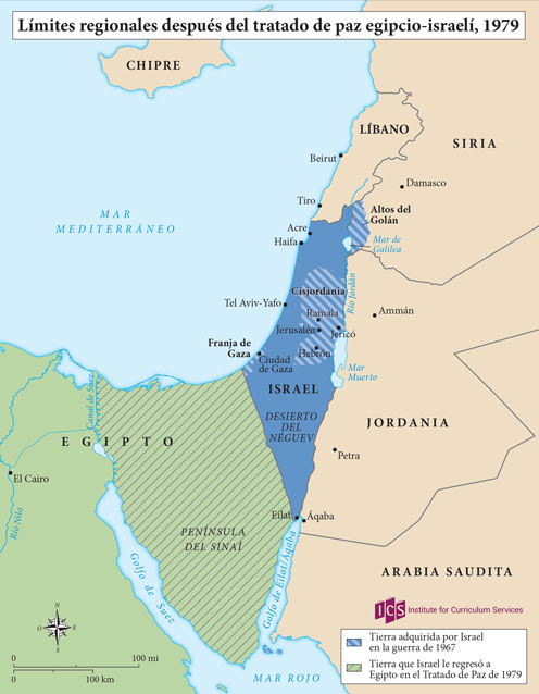
Spanish 09 – Límites regionales 1979
Spanish 10 – Límites regionales 2005

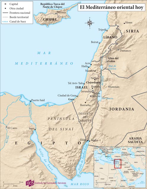
Spanish 11 – El Mediterráneo oriental hoy